

28
Aug
What to Expect in Tampa Bay Hurricane Season 2026
Tampa Bay Hurricane Season 2026: What Homeowners Should Know
Living in Tampa Bay means you should be ready for the Atlantic hurricane season. The 2026 forecast for the Gulf Coast brings both good news and some bad. This is what the experts at the National Hurricane Center and AccuWeather say you need to know for this year’s hurricane season. For local help, see Tampa storm damage repair.
- AccuWeather says there will be 11 to 16 named storms in the 2026 Atlantic hurricane season.
- Out of these storms, four to seven could be hurricanes, and two to four may turn into major hurricanes.
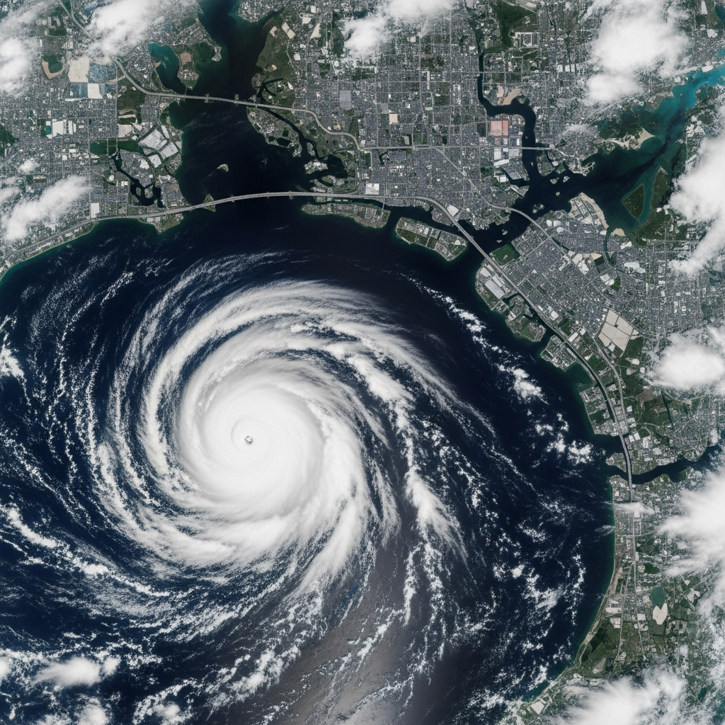
- This year, the National Hurricane Center says the Tampa Bay area is at a higher-than-average risk from hurricanes.
- One big worry for people living on the Gulf Coast is the rapid intensification of storms near the shore.
- A new El Niño climate pattern will also have an effect on the number of storms and how strong they get.
Be sure to stay informed as things can change fast during hurricane season.
Introduction
As we get closer to the 2026 hurricane season, people in Tampa Bay are starting to wonder what the weather will be like this year. The last hurricane season in 2025 was calm, and no hurricanes hit the United States. Now, weather experts are looking at what could happen next. The forecast shows there may be a normal or even a lower number of storms this year. Still, a single strong tropical storm can bring a lot of trouble to the area. Knowing the forecast can help you get your home and your family ready for what may come. Let’s take a look at the predictions for this hurricane season.
2026 Hurricane Season Predictions for Tampa Bay
People who tell the weather are keeping a close eye on the Atlantic basin as we get closer to the 2026 hurricane season. There could be about the same number of storms as usual. But the big concern is where each tropical storm goes. That is what really matters for people living near the water. The United States may get hit by three to five of these storms this year. This is more than what we saw last time.
Tampa Bay should pay extra attention. The experts said that Florida’s Gulf Coast has a higher than normal chance this year. It is important to check tools like the tropical outlook map to keep track of what happens. Let’s see the number of storms and if any could be strong ones.
Expected Number of Named Storms and Hurricanes
The forecast for the 2026 Atlantic hurricane season predicts a range of storm activity. AccuWeather forecasters anticipate between 11 and 16 named storms. This number is close to the 30-year average, which is 14 named storms. The lists of hurricane names are prepared in advance, with the first storm of 2026 set to be named Arthur.
Within that total, the prediction calls for four to seven hurricanes. Of these, two to four are expected to become major hurricanes, which are storms reaching Category 3 strength or higher. This is also in line with the historical average of seven hurricanes and three major hurricanes per season.
Here is a comparison of the 2026 forecast against the average Atlantic hurricane season:
Storm Category | Average Season (1991-2020) | 2026 AccuWeather Forecast |
|---|---|---|
Named Storms | 14 | 11-16 |
Hurricanes | 7 | 4-7 |
Major Hurricanes | 3 | 2-4 |
Major Storms Likely to Affect the Florida Gulf Coast
The total number of storms matters, but people in Florida mostly worry about where the storms will hit. This year, there is a lot of focus on the Gulf Coast. Alex DaSilva, who is the lead hurricane expert at AccuWeather, said the area from Tampa up to the Big Bend of Florida has a bigger risk of a major hurricane hitting this season.
This higher risk comes from looking at years with the same kind of weather patterns. In those years, many storms came close together in the north and northeast part of the Gulf Coast. The chance that one of the major hurricanes will come to this area means people should not take it easy or think it will not happen.
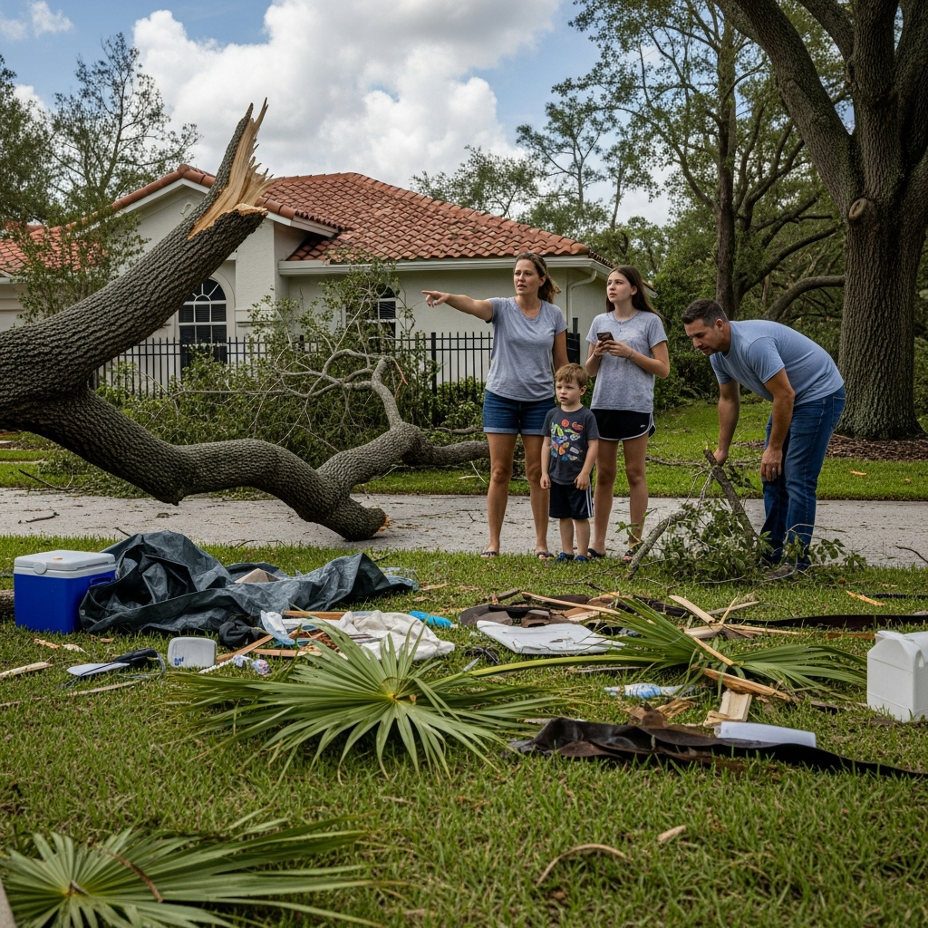
Even when a storm does not hit the Gulf Coast or the Big Bend of Florida right away, it can still cause a lot of problems. Strong winds and heavy rain can cause big power outages and flooding. People often need help from water damage cleanup teams after that. It is important for everyone who lives on the coast to get ready for what may be a tough hurricane season.
Key Factors Shaping the Tampa Bay Hurricane Outlook
Many big weather and ocean forces will shape the 2026 hurricane season. These work together and decide how much tropical activity there will be. Experts look at water temperatures and wind shear before they give their guesses. One big climate pattern to watch this year is the growing El Niño.
These key factors change how often storms form, how strong they get, and which way they go. The very warm water temperatures in the Atlantic could help the storms grow. At the same time, other things may stop them. Let’s take a closer look at these patterns now.
Climate Patterns Impacting Storm Development
The way a tropical cyclone forms is shaped by some big weather patterns. In the 2026 season, the people who track these storms are watching things that can help or stop storms from growing. There are very high sea-surface temperatures, which give storms the power they need to get stronger.
But having warm waters is not the only thing needed for an active storm season. What happens in the air above matters, too. For example, wind shear can have a big effect on storms. If wind shear is strong, it can break a storm up. If there is not much wind shear, the storm can get bigger and stronger. So, the tropical outlook for 2026 will come down to how these things mix together.
There are some key factors for the 2026 season:
- Very high sea-surface temperatures: Warm waters, mainly in the Gulf of Mexico and off the southeast coast, can help storms develop quickly.
- Developing El Niño: This weather pattern often brings more wind shear to the Atlantic, making it harder for storms to grow.
- Saharan dust: Dry air from Africa can take away moisture and keep the air stable. This makes it tough for a tropical cyclone to form.
Influence of El Niño on 2026 Hurricane Activity
The growing El Niño is one of the most important things to watch for in the 2026 hurricane season. This climate pattern means that the water on the surface of the central and east parts of the tropical Pacific Ocean gets warmer. Even though it starts in the Pacific, it can change weather all over the world, even in the Atlantic basin where hurricanes often begin.
Most of the time, El Niño makes it harder for hurricanes to grow. It does this by boosting wind shear over the Atlantic, which can block storms from getting stronger. Because of this, hurricane seasons with a strong El Niño are often calmer than usual. You can see these changes on a tropical outlook map and check a tropical outlook for updates.
Still, how strong and when El Niño happens matters a lot. Experts think it will show up this season and get stronger by fall. If there is a “super El Niño,” it could make October and November much quieter, with fewer storms at the end of the year.
Assessing Tampa Bay’s Risk Level in 2026
Knowing your own risk is important when getting ready for a hurricane. For 2026, Tampa Bay is seen as a high-risk place. This comes from AccuWeather’s lead hurricane expert. He said the gulf coast, mainly from Tampa and going north, has a bigger chance of being hit by a storm than the historical average.
This does not mean there will be a storm for sure. It just means the chance is higher than normal. People who live in this area should take this news in the right way and get ready. Let’s look at which places could be in more danger and how this year’s risk is different from past seasons.
High-Risk Areas in Tampa-St Petersburg (Sarasota), FL
Some places in the Tampa Bay area are more in danger than others. The Gulf Coast’s shape means that parts down by the water are at greater risk when storms hit. These the low-lying coastal towns are more likely to get hit by storm surge. It is often the most dangerous part of a hurricane. If a storm has a direct impact here, there could be a lot of people dealing with high floods and damage.
They call 2026 a high-risk year because the weather may push more storms into the north and east parts of the Gulf of Mexico. That puts people from Sarasota up through the whole Tampa-St. Petersburg metro area on high alert.
Here are some things to know if you are in a high-risk spot:
- Coastal neighborhoods: These folks are in the most danger when it comes to storm surge and strong winds.
- Low-lying zones: These spots can flood easy from lots of rain and are at a lot of risk, too.
- Mobile home parks: A mobile home cannot stand up well to hurricane winds, so these homes are in more danger.
- Areas with dense tree cover: Trees and branches can fall in a storm, causing home damage and power to go out.
Comparison with Previous Hurricane Seasons
To put the 2026 forecast into perspective, it helps to compare it with previous years. The 2025 Atlantic hurricane season, or last year, was relatively quiet for the United States, with no hurricanes making landfall. The season produced 13 named storms and five hurricanes, but most curved away from the coast. This was a welcome break after the very active seasons before it.
The 2024 season, by contrast, saw three hurricanes make landfall in Florida, including Hurricane Milton near Siesta Key. The 2026 forecast of 11-16 named storms is similar in number to 2025 but carries a higher threat of direct impacts, making it more akin to the risk profile of earlier, more active years.
This table shows how the last few seasons compare:
Year | Named Storms | Hurricanes | Major Hurricanes | U.S. Landfalls |
|---|---|---|---|---|
2026 (Forecast) | 11-16 | 4-7 | 2-4 | 3-5 (Predicted) |
2025 | 13 | 5 | 4 | 1 (Tropical Storm) |
2024 | Not specified | 3 (in FL) | Not specified | 3 (in FL) |
Historical Average | 14 | 7 | 3 | Varies |
Tampa Bay Hurricane Preparedness Tips for 2026
The Tampa Bay area has a higher chance for storms this hurricane season. It is key to get ready early. The right steps can help a lot if a hurricane comes. You need a plan, the right supplies, and you must keep up with news. When a hurricane watch gets announced, it is time to finish your prep.
Signing up for local weather alerts is easy and works well. It helps you stay on top of new warnings. Do not wait until the storm is close to act. These are some good ways you and your business can get ready.
Safety Measures for Residents and Businesses
The best way to stay safe during a hurricane is to get ready long before the storm starts. If you wait until weather alerts say there could be a direct impact, it may be too late to get all you need. Make a hurricane kit early with things like water, food that won’t go bad, batteries, a flashlight, and a first-aid kit.
If you own a business, getting ready means keeping your building safe and having a plan to keep working. You should back up all your important data. It helps to make a plan to talk with your team. When you hear about a hurricane watch, that is the time to use your plan.
Follow these key safety measures:
- Create an evacuation plan: Know your evacuation zone and pick a spot for your family to meet.
- Secure your property: Put up window covers, take loose things out of your yard, and cut back tree branches.
- Review your insurance: Look at your homeowner’s or renter’s plan. Make sure you are covered for wind and flood.
- Stay informed: Watch weather alerts and listen to orders from officials.
- Build a kit: Put together all the things you will need in an emergency to last your group at least 72 hours.
Important Dates and Seasonal Timeline
Knowing the timeline for hurricane season helps you stay ready. The official Atlantic hurricane season lasts six months. But, storms do not happen equally in all months. Some months are much busier. The start of hurricane season is the same every year. Still, the first storms can come before this date.
The National Hurricane Center gives updates every day during the season. This helps keep you and your family in the loop. It is smart to know this timeline and spot the busy months. These months are the times to be extra careful. Here are the main dates for the 2026 season.
Hurricane Season Start and Peak Months in Tampa Bay
The hurricane season for Tampa Bay and the whole Atlantic basin begins on June 1. It ends on November 30 each year. There can be storms before this time, though. Some storms may form in May, before the official start of hurricane season.
Storms can happen at any time during these six months. Still, the number of storms usually goes up as the season moves along. The busiest time is between the middle of August and the middle of October. The climatological peak for hurricanes, when the strongest storms happen, is on September 10.
Key timeline facts for Tampa Bay people:
- Hurricane Season Start: June 1
- Hurricane Season End: November 30
- Peak Months: August, September, and October
- Climatological Peak: September 10
National Hurricane Center Updates to Watch
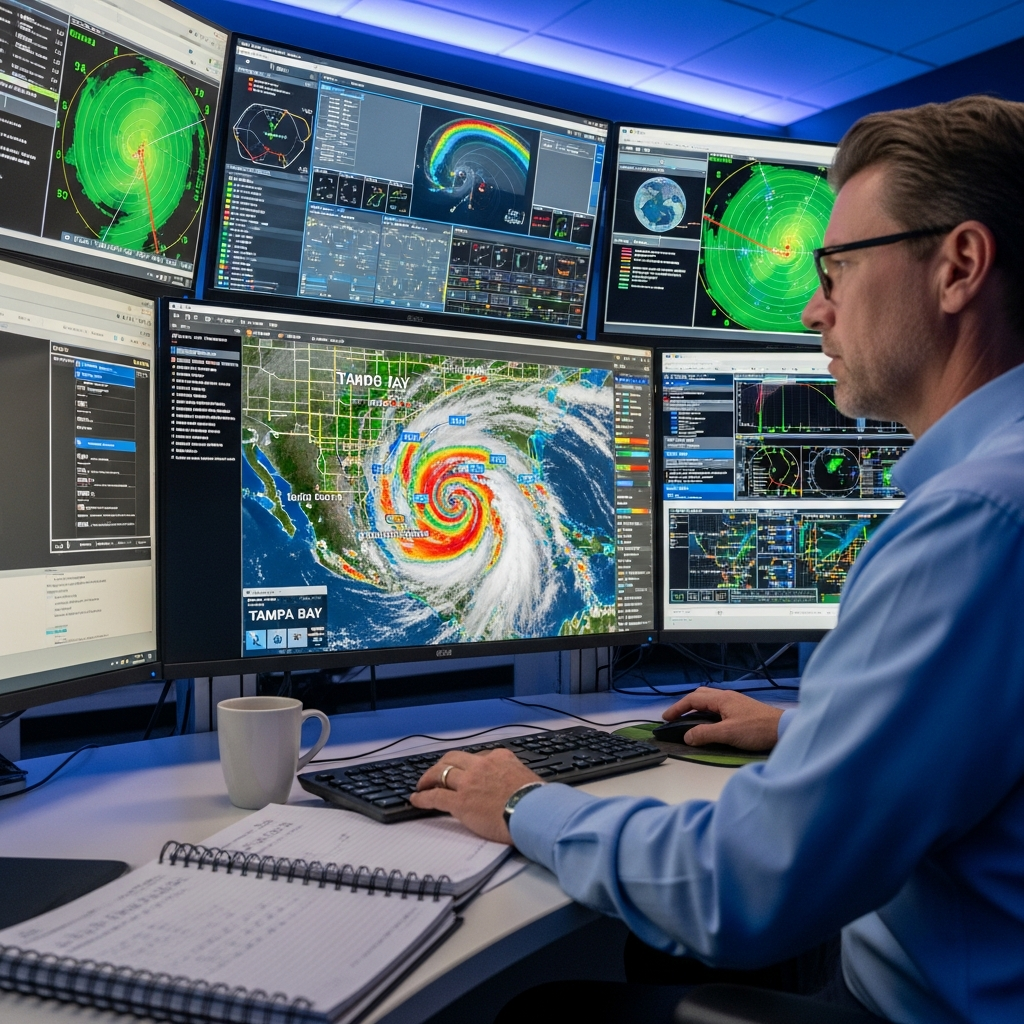
The National Hurricane Center (NHC) is the main place for all news about hurricanes. People should follow what they say, especially when the season starts. The NHC will give its regular Tropical Weather Outlooks every day starting on May 15. These updates show a forecast for seven days and tell you where storms could form.
One of the tools people know best is the forecast cone. Some call it the cone graphic. This shows the most likely path for the center of a storm. It’s good to keep in mind that problems can happen outside this cone. The NHC keeps working to make its alerts better, so the public can know their risk.
Watch for these main updates from the national hurricane center:
- Tropical Weather Outlooks: These come out four times a day, starting on May 15, and point out where storms could start growing.
- Public Advisories: These tell you exactly where a storm is, how strong it is, and what warnings there are.
- Forecast Cone Graphic: This tool shows the likely way the storm’s center will go.
- Storm Surge Watches/Warnings: These let you know if there might be serious flooding because of water coming up.
The forecast cone from the national hurricane center helps people stay ready. You can follow all updates and more at the hurricane center’s site.
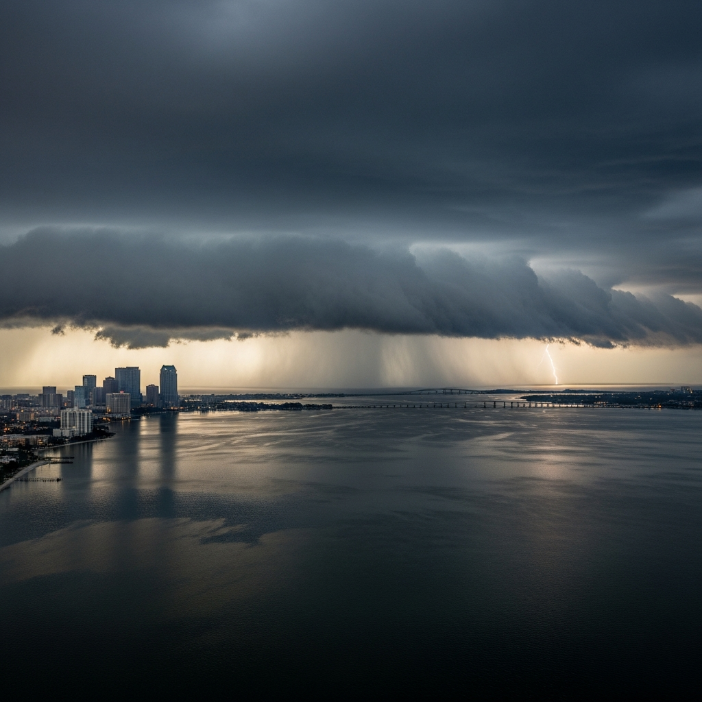
Rapid Intensification Concerns for Tampa Bay
One of the biggest dangers you can face during hurricane season is rapid intensification. This means a tropical storm can get much stronger in just a short time. It is a big worry for the 2026 season. The very warm waters in the Gulf of Mexico can make this happen more often, and this adds to the risk of rapid intensification for storms moving toward Tampa Bay.
A storm can go from a handling tropical storm to a strong hurricane overnight. People will have less time to get ready or leave if needed. It is important to know the signs of rapid intensification and what to do so you can stay safe.
Signs of Fast-Strengthening Storms in the Region
Rapid intensification means that a storm’s top winds go up by at least 35 mph in twenty-four hours. This strong rise happens when a tropical storm or hurricane gets into a spot with everything it needs to grow quickly. People who tell us about the weather see this as a big risk in 2026, mostly near the U.S. coast.
The main thing a tropical storm needs for rapid intensification is deep, warm waters. These waters give the storm extra power. If a storm moves over these warm waters and finds low wind shear with lots of moisture in the air, it can get much stronger very fast. In 2025, there were storms that were on the weaker side, but the ones that became stronger did so quickly and in a big way. This could happen again.
Here are signs of a greater risk of rapid intensification:
- A storm moving over warm waters that are hotter than usual.
- Forecasts from the NHC talking about low wind shear.
- The storm shows up well and gets organized fast on satellite images.
- Calling for a tropical storm to turn into a major hurricane in a short amount of time.
How Residents Should Respond to Rapid Changes
Rapid intensification means you will have less time to get ready, so you have to act fast and know what to do. When you hear from weather experts that there is a risk of rapid intensification, do not ignore it. Take this very seriously. You need to have your hurricane plan set and be ready to use it right away.
It is important to keep up with all official weather alerts. If there is a hurricane watch for your area and a risk of rapid intensification, speed up your plans. Do not wait for the storm to get stronger to do things. Secure your home, get your supply kit set, and be ready to go if the city asks you to leave.
Here’s how you can act when the storm changes fast:
- Heed all warnings: Follow what local emergency people say right away.
- Accelerate your plan: Move fast. What you may want to do over two days, go ahead and do it in a few hours.
- Stay off the roads: If things get bad, stay inside. If you are in a place that needs to leave, do it early.
- Communicate your status: Let your people know your plan and when you are safe.
Conclusion
As we get closer to the 2026 hurricane season in Tampa Bay, it is important to be ready and know what is going on. There are signs that say there may be more named storms this year. That, along with changes in the weather like El Niño, means you should know your risk and what safety steps to take. This is true for both homes and any business you may have. If you know the usual timeline for hurricane season and can spot when storms get strong fast, you will help keep yourself and those around you safe. Getting ready for a storm ahead of time really can help. Keep up with news from the main sources and be careful as things change in the season. If you want advice just for you on hurricane season, think about asking for a meeting about how to be even more ready.
Frequently Asked Questions
Are more hurricanes expected in Tampa Bay this year than last?
The 2026 forecast for the Atlantic hurricane season shows there will be about the same number of storms as last year. But experts say the risk for Tampa Bay is higher this time. They expect more storms will hit the United States directly, and the Florida Gulf Coast is the main area to watch.
What is the best way to prepare for a hurricane in Tampa Bay?
The best thing you can do before hurricane season is to make a hurricane plan. You should also put together a disaster kit ahead of time. Stay updated with weather alerts and know your evacuation zone. When a hurricane watch is announced, make sure to secure your home. Taking these steps early is very important to keep everyone safe in Tampa Bay.
When should residents start following local hurricane updates?
People in the area need to start checking the tropical outlook from the National Hurricane Center from May 15. Be sure to follow all updates during hurricane season. It is very important, especially when there is some bad weather close to Tampa Bay, or if a hurricane watch is announced for the area. See see how we handle water damage.
Latest Posts
Contact Us
For Advice
Need help? Talk to an expert
(813) 261-1525